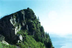
Dent de Jaman and Rochers de Naye
These are located in Vaud prealps, comparatively close to Lausanne, straight
above Montreux and Villeneuve. Dent de Jaman (1825 m a.s.l.) is well visible
from the highway Lausanne - Villeneuve (just before exit to Montreux) as a big,
tooth-like rock. Its side towards the lake is almost vertical, the opposite
side, although steep, can be climbed without any special rock climbing
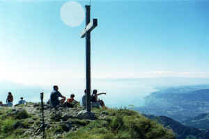
techniques. There is a path, leading to the top, where, as often happens, big
wooden (oak?) cross is installed. See the map of area at walking profile page.
 |
 |
|
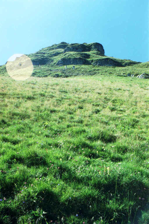
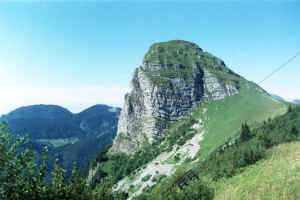
Dent De Jaman. Left side - towards the
lake. |
At the top of Dent De Jaman. |
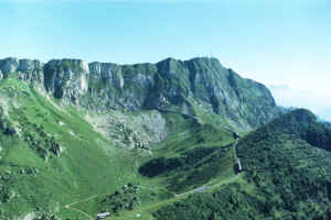
Rochers de Naye is a top point (2041 m a.s.l.) of a ~1 km tilted ridge, on
the South from Dent de Jaman. There is a cog wheel train going during summer
time from Villeneuve to Glion, Caux up to Rochers de Naye. Train upper station
is built at the back side of Rochers de Naye, almost at the top. It has a couple
of restaurants, one of which is reached via a long tube through the rock - to
the side facing the lake, and offers a beautiful panorama.
 |
 |
 |
|
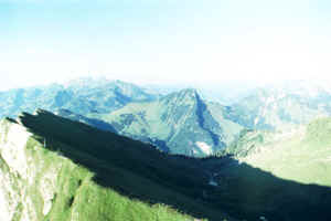
Rochers de Naye. The view to the South
from Dent De Jaman |
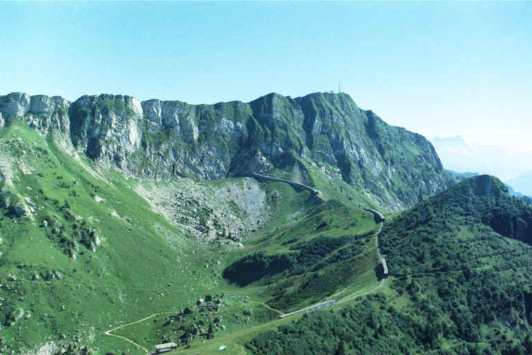
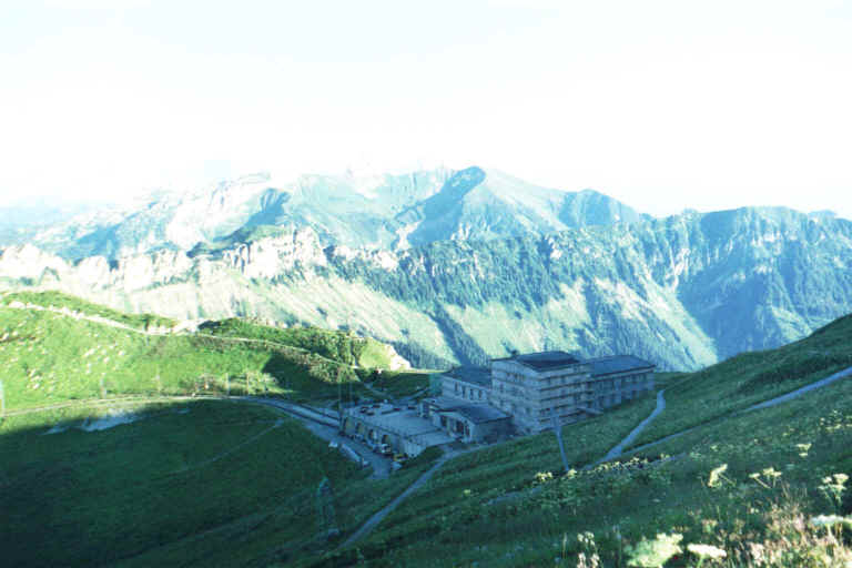
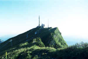
This is the summit of Rochers de Naye.
Not very romantic. Mostly occupied by antennas. |
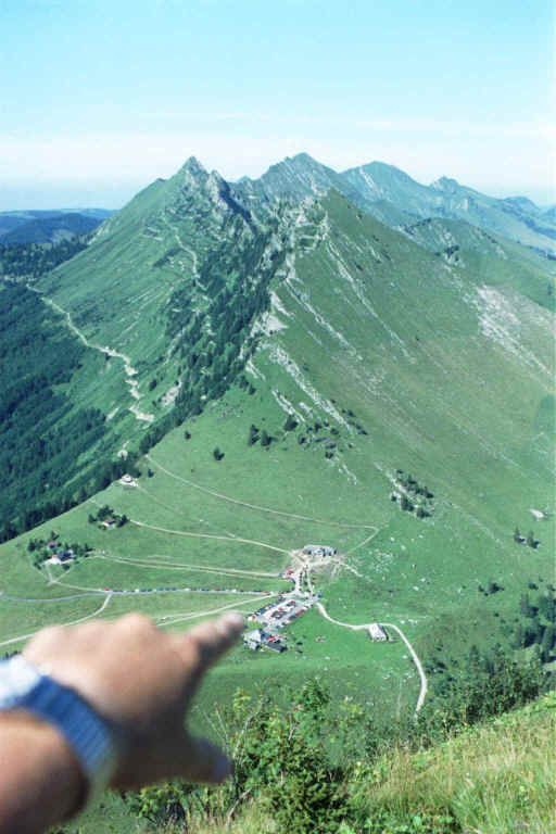
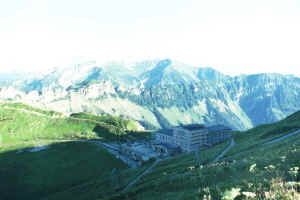
And this is the upper station of
cog-wheel train - a little below the summit. |
 |
|
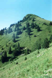
Le Merdasson as seen from the feet of
Rochers de Naye. |
There are numerous walking routes in the area. The best way is to go by car
and leave it at the Col de Jaman parking, next to the chalet-like restaurant. I
continued by foot to the South, up the slope of Dent de Jaman, passed it from
the left, and then climbed to the summit. Then to Le Merdasson (1858 m a.s.l.),
Sautodox (1832 m a.s.l.), Rochers de Naye (2041 a.s.l.), down along the edge of
the ridge to the place where descend to Grottes de Naye begins.
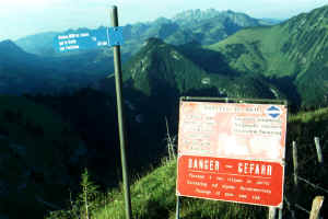 |
| Here is the warning before
descend to Grottes de Naye: "Danger. Passage at your own risk."
There is not much of a risk, really. |
There is a warning board installed at this place (see at the left), telling
you that you are going to do it at your own risk, etc. Well, I think it is an
overkill. This descend, although steep, is not more dangerous than many other
routes, which are not supplied by such warnings. Most steep pieces are equipped
with chains and ladders. If you are physically fit, the descend will not cause
you major difficulties. Those who likes exploring caves can go inside of Grottes
de Naye at the bottom of the descend. I personally do not like these wet and
chilly rat holes.
 |
 |
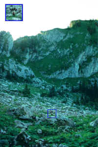
| Col de Sautodox. Right after
an exhausting climb up. |
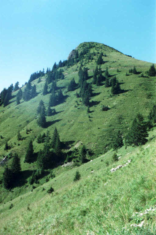
This is Sautodox itself. Very
small peak if you already at the Col de Sautodox :) |
The last piece of the route lies from the caves to Col de Bonaudon, then down
to the valley and back to Col de Jaman.
Look at the map for the
route trace.
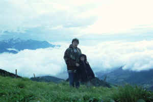
Due to the proximity of densely populated lake shore, this area is very
popular and on summer weekends is normally packed with tourists, so you will not
be alone. From late autumn until mid of June, outside of the peak of tourist
season, cog wheel train does not work and this area is fairly deserted and looks
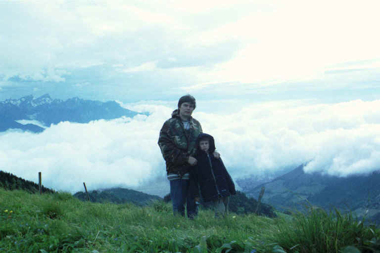
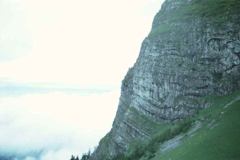
pretty wild. I was at Dent de Jaman together with my son and my friend on June
6. Some spots were still covered with snow. We did not meet anyone, except hares
and mountain goats. Standing above clouds level, Dent de Jaman looked so hostile
that we returned from half way up. (see two photos below)
 |
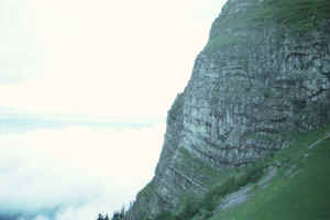 |
| Dent de
Jaman early in June |
To get to the area is easy. First you have to take an auto route Lausanne
Villeneuve and leave it at the exit to Montreux, but turn to the opposite
direction - up the hill, towards Les Avants. The road will weave and bend, but
don't worry, always follow the signs "Les Avants". As you reach Les
Avants, you should pass it through and follow the signs "Col de
Jaman". The road is narrow, but not steep and is good enough. For more
detailed driving direction, please see the result
of the query to MS Autoroute here.
 |
 |
 |
| View from Le Merdasson to |
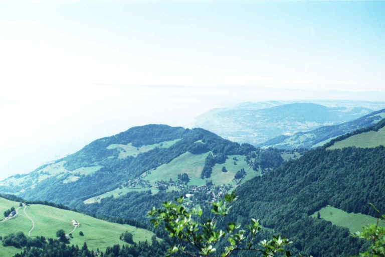
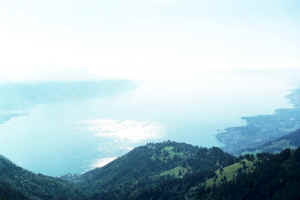
View to the lake from Col
de Sautodox |
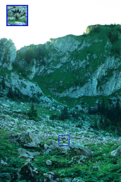
Wild animals are not rare.
This deer was completely ignoring me. Pity, I had only wide lenses. |
|
|
|
 |
 |
 |
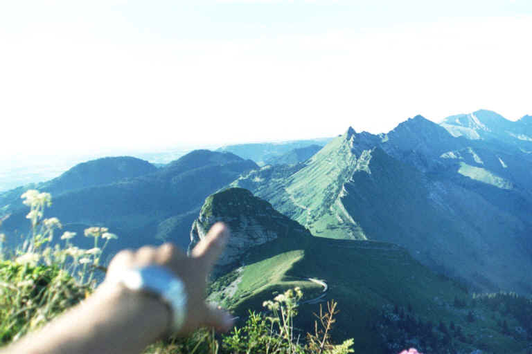
| At Rochers de Naye: there
is Dent de Jaman. Does not seem to be very big... until you start to
climb it. |
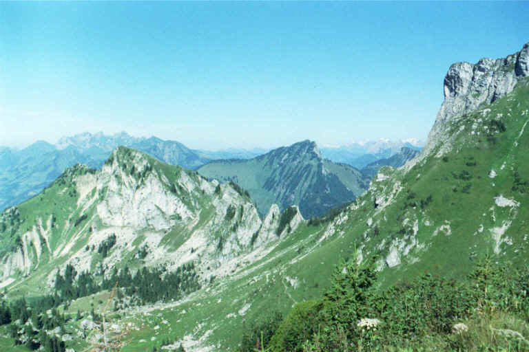
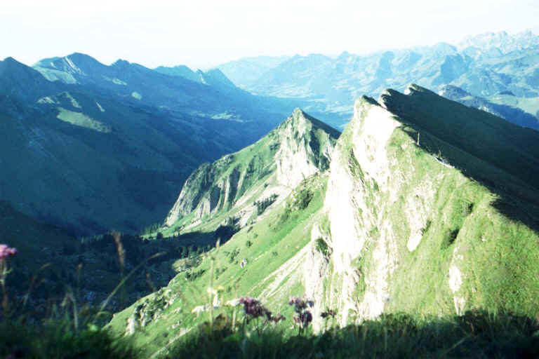
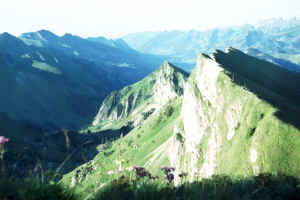
View from Rochers de Naye
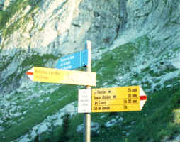
to the neighboring ridge. |
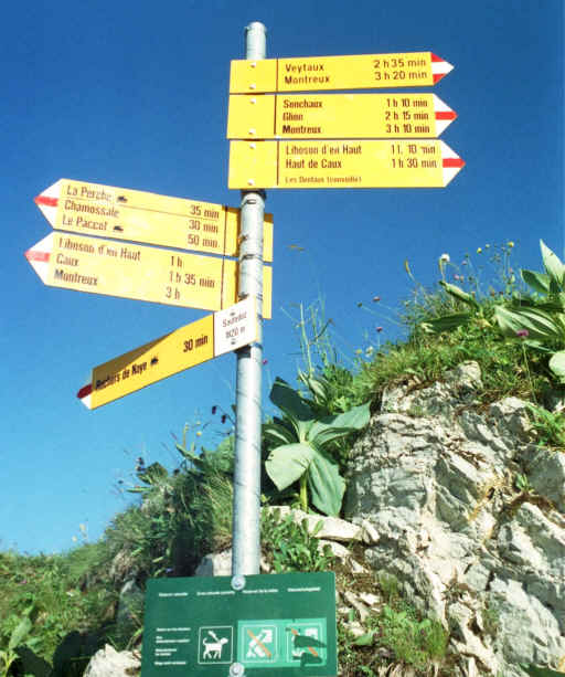
Way signs at Col de
Bonaudon. |
|
|
|
 |
 |
|
| View from Rochers de Naye
to the neighboring ridge. |
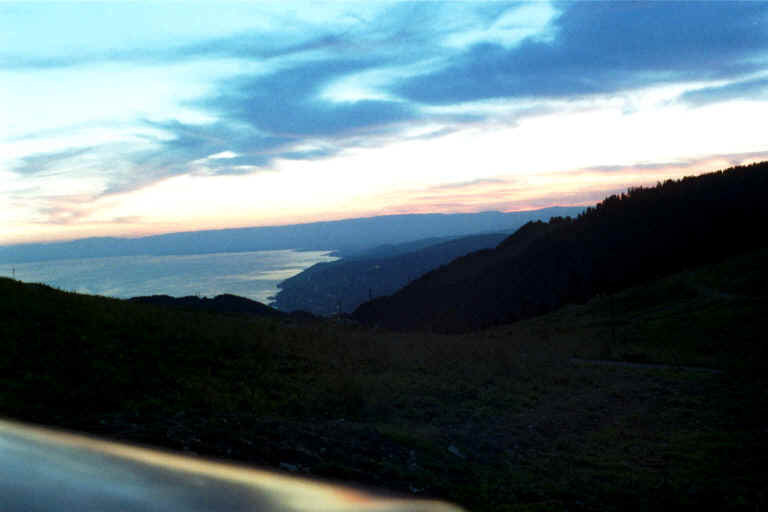
The sunset at Col de Jaman. |
|
|