|
There is such a great tool in the world as GPS. Some day I will have to write
more about the way I use it. For the moment, please see below several charts,
which will give you a better idea about the route.
 |
|
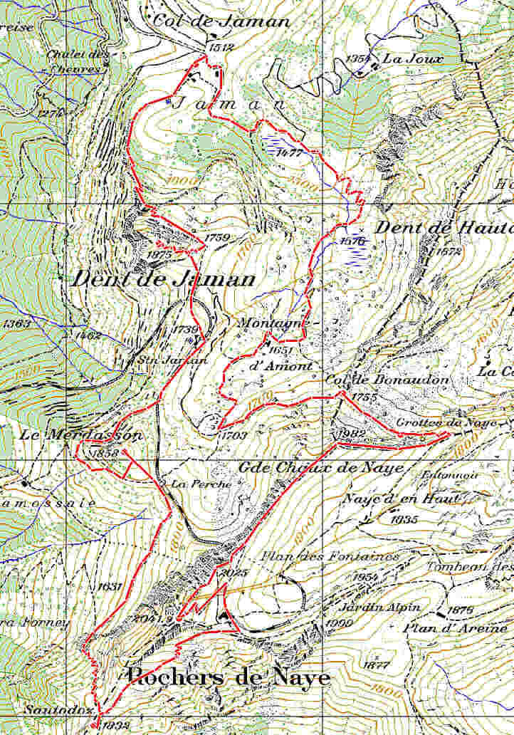
This is a piece of 1:25,000 map of the
area. Start at the top - Col de Jaman. Walk against clock wise. Finish
at the start. |
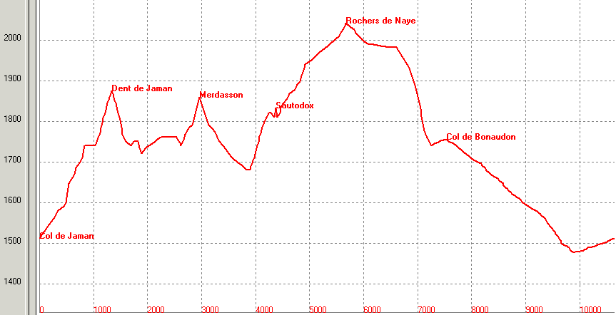 |
| Walking profile. Please note that
vertical scale is much larger than horizontal - it allows to see better
all route peculiarities. Of course you don't need to climb 70° slopes!
Proportional profile is two graphs below. |
|
|
 |
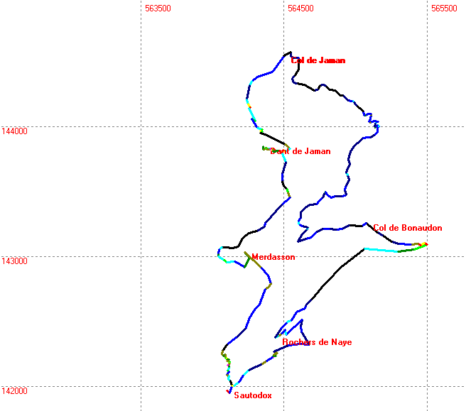
| Route land
projection. This contour repeat track of the topographical map above.
The value is in coloring scheme: the brighter color - the steeper piece
of the track is. See legend at the right. Note that these are not
degrees, but percents: 50% means 50 m up per 100 m along. |
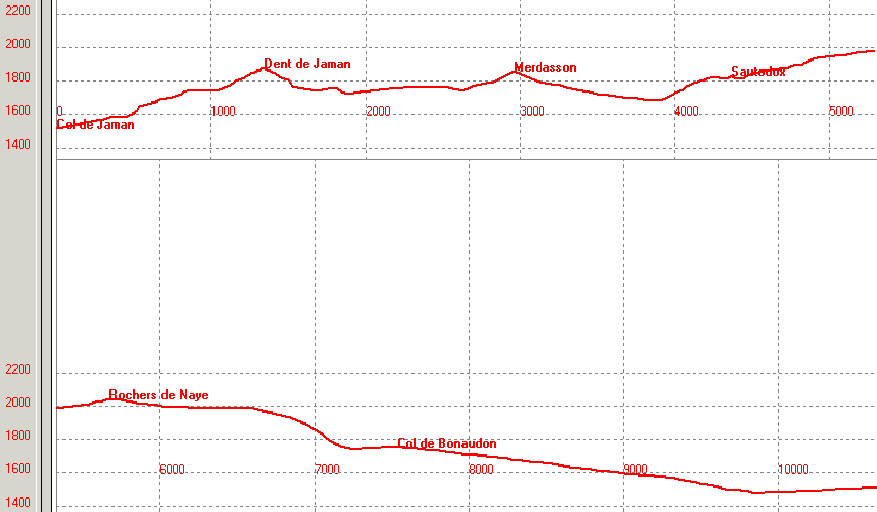 |
| Real, that is proportional walking
profile. Seems to be very smooth, but don't get misled. It is because
path makes zigzags (thus severely decreasing the ascend angle), rather
than goes straight against the slope. Real slopes are steeper than this
graph angles, but the path crosses slopes at exactly this angle! |
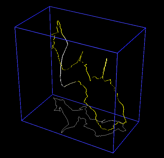 |
| 3-dimentional projection. Extremely
disproportional for the sake of showing details. The start point is at
the right bottom corner. First surge - Dent de Jaman, second surge - Le
Merdasson, upper point - Rochers de Naye. |
|
