![]()
![]()
![]()
![]()
![]()
|
|
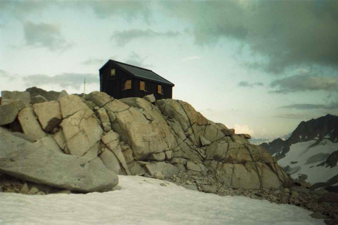
Saleina - Rocks and Glaciers
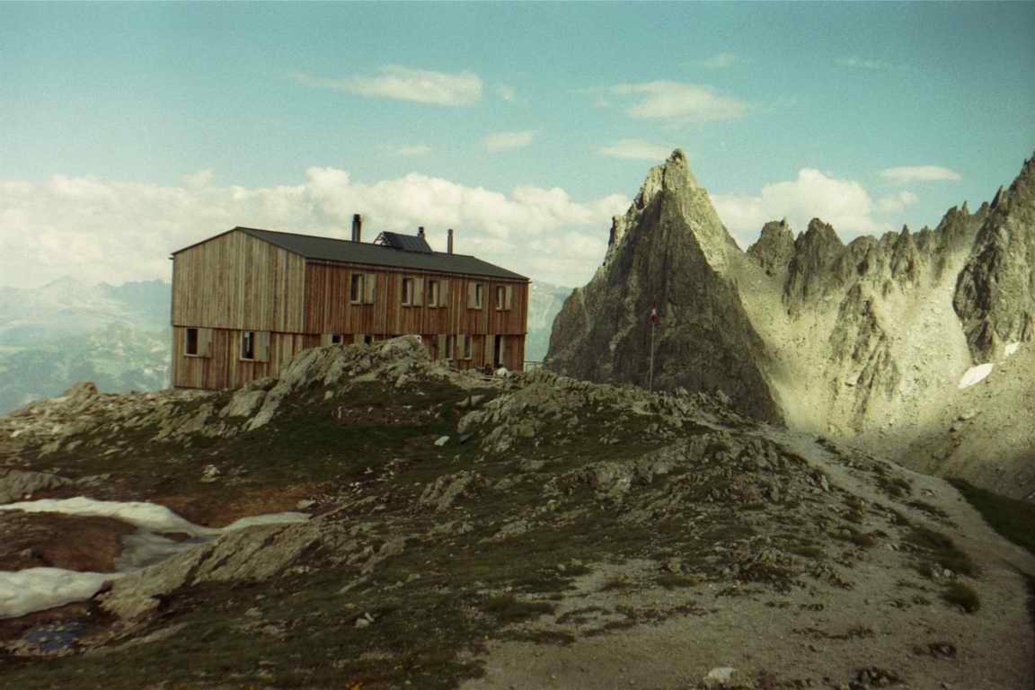
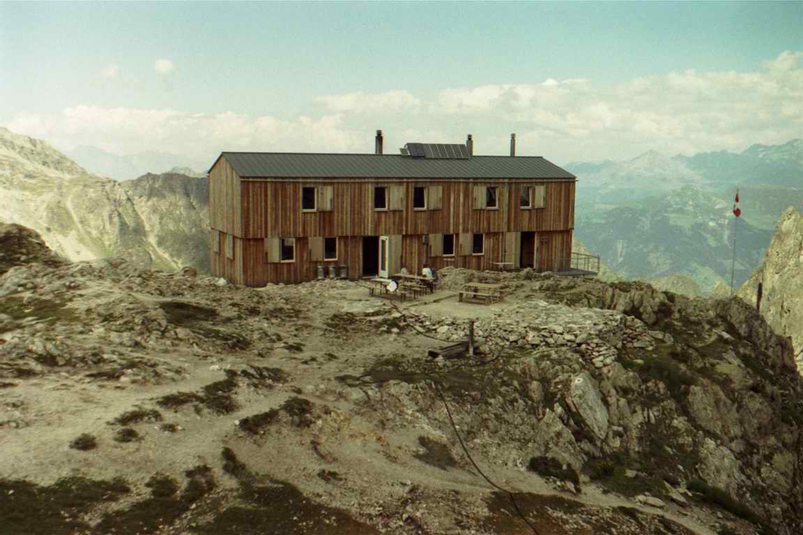
There are places where you've been many times and still can not remember it, and there are places, where you have been once, but remember it all to the last detail. These experiences are ones, which break you life pattern and leave you with something wonderful to recall years and years after. Saleina is definitely one of them. First - the route to Cabane de Saleina is challenging, but exceptionally interesting and rewarding. Second - the location of the cabane. It was brilliantly placed on a big rock between sharp peaks high above it and marine blue cracked Glacier de Saleina far below. Third plus - there are excellent routes from the cabane further deep into the Mountain wilderness. To get there you first have to drive up to a small village Praz de Fort (see topo map). Right at the village entrance turn right, leaving the main road. Drive straight, cross a small stream and just before the bridge over a bigger stream turn again right. This road will lead you to the right place. First surfaced and then unsurfaced (but good enough anyway) it will bring you to a small dam, "Prise d'eau de Saleina". Leave a car there and take a well marked path below the dam. Instead of going West, it goes first to a wrong direction - to the South, but don't worry, it will turn soon. It goes up along a ravine, which becomes more and more narrow. Following this path for approximately one kilometer you will finally come to a rocky wall, where the most interesting part of the route lies. To proceed further you will have to climb several steep sections, equipped with chains. Some pieces are quite exposed, falling down is not recommended. If you want it to be 100% secure, you can attach yourself to the chains, the most of people, however do not do it. After overcoming the last chain, you get up to Plan Monnay - small plateau, covered by mountain cranberries and bilberries bushes. This is a nice place for a short break, especially because the rest of the route ahead is fairly steep. Further on follow the path meandering through rocky slopes - there is no problem with navigating oneself there. Last serpentine up the final rock and you are at the cabane de Saleina, alt. 2693m. Cabane de Saleina was recently renovated, if not to say, rebuilt. It looks very nice outside and it is cozy inside. See pictures at the top.
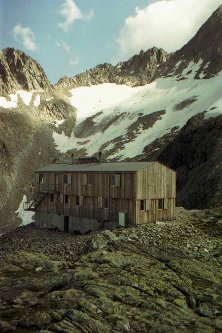
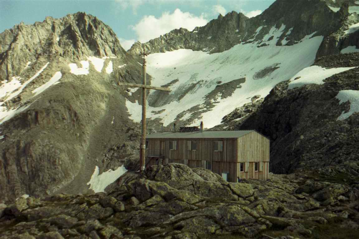
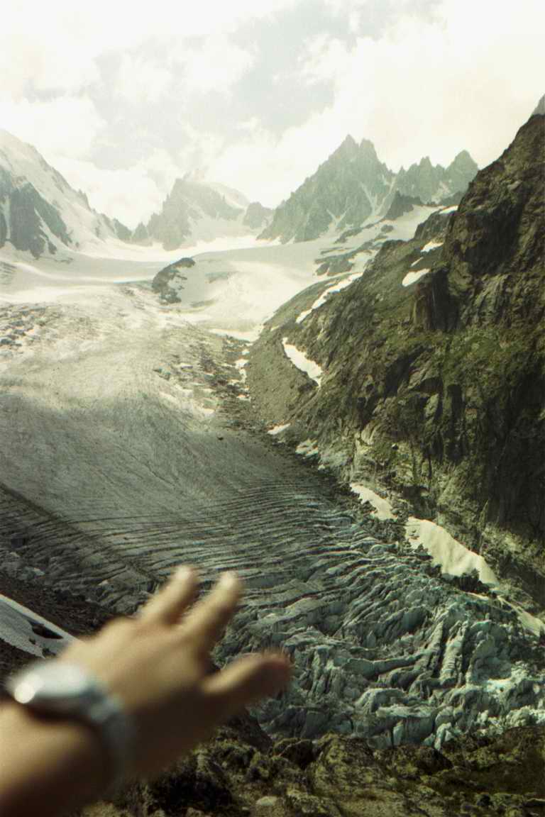
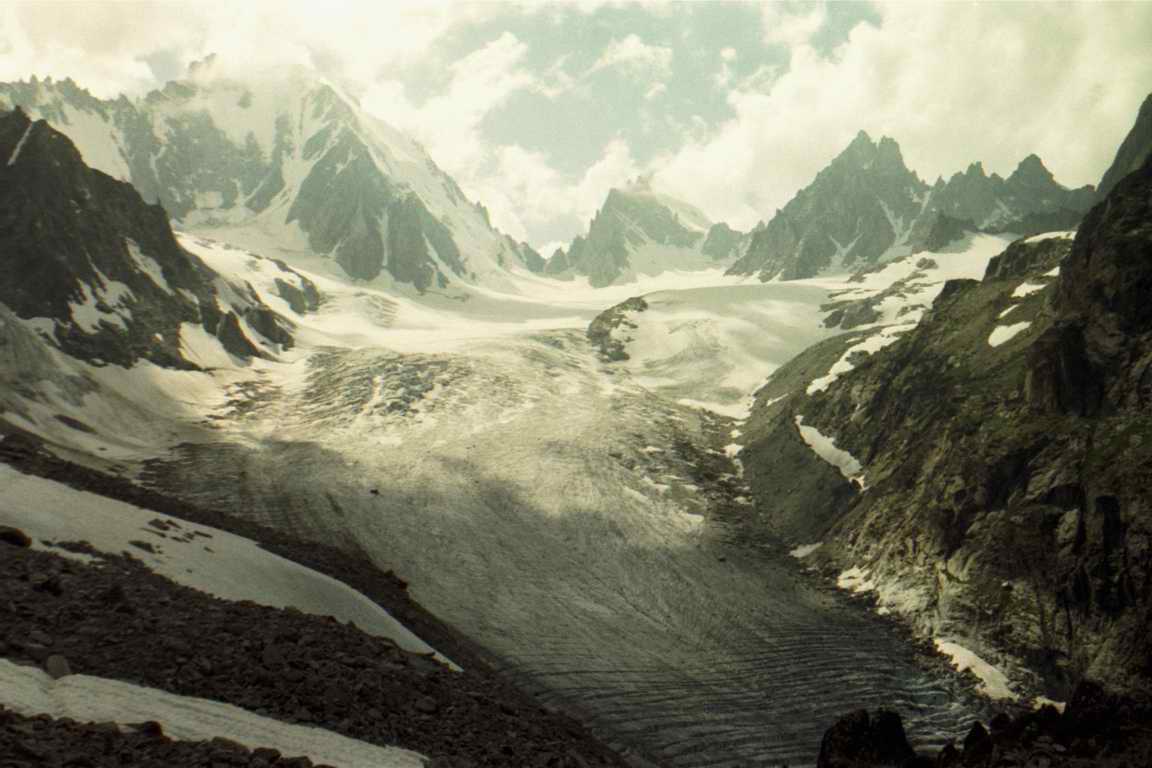
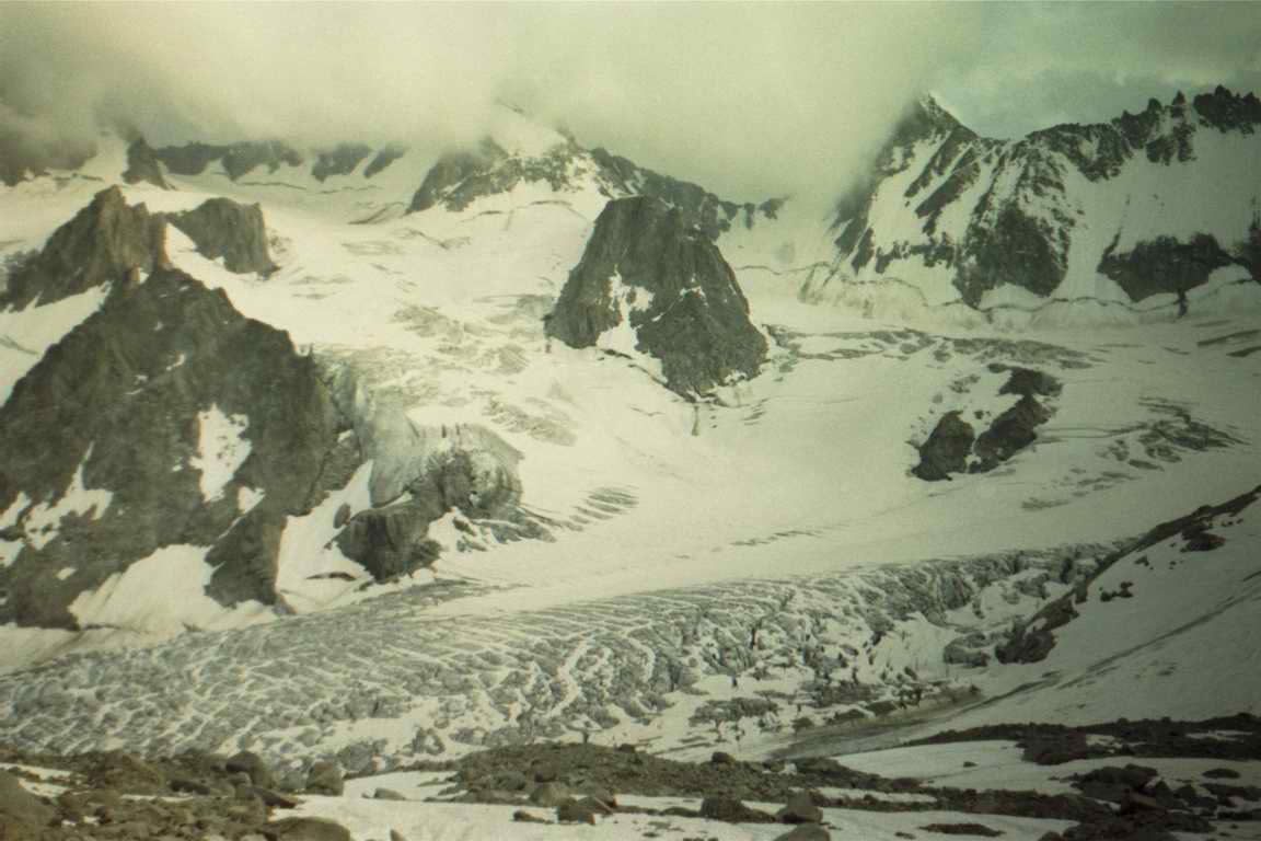
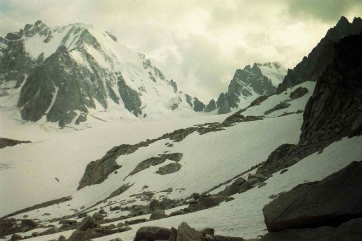
Views from the cabane location are absolutely marvelous and breathtaking (see on the right). There are many opportunities for further walk from the cabane, for example to Grand Lui mountain. But be careful, it is not trekking solid ground anymore. Better if you are prepared to walk glaciers and you must not be alone. Two day before I was there, four dead bodies were pulled out of one of the crevasses between Cabane de Saleina and Cabane de la Neuve. I, personally, explored only one further route, probably the easiest one - to the bivouac Envers des Dorees. It is an interesting, but not extremely difficult walk across Saleina Glacier to a mountain wildness. First you need to descend 90m from the cabane to the glacier along the right (southern) bank of the glacier. Then you need to cross the glacier (beware of crevasses!) and get up to the big serak at the opposite bank. The path continues West along the serak ridge until p. 2759. Turn North and, following path marks, you will reach the bivouac 220 m higher. The whole scenery around and the bivouac are at the pictures below.
| |||||||||||||||||
|
|