|
 |
|
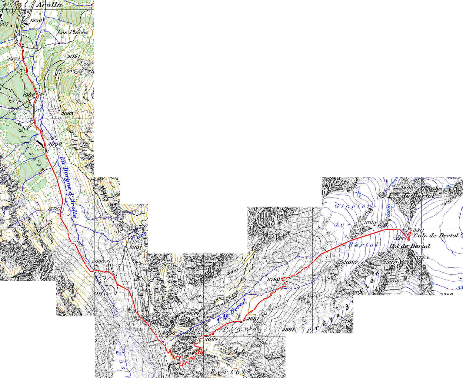
This is a piece of 1:25,000 map of the
area. Start at the top -Arolla. If you are not 100% law-abiding, you may
want to violate one ""red circle" road sign and drive up
to "Illegal parking". I noticed that good percentage of Swiss
do it. This way you will avoid least interesting part of the walk and
save ~ 20 min. |
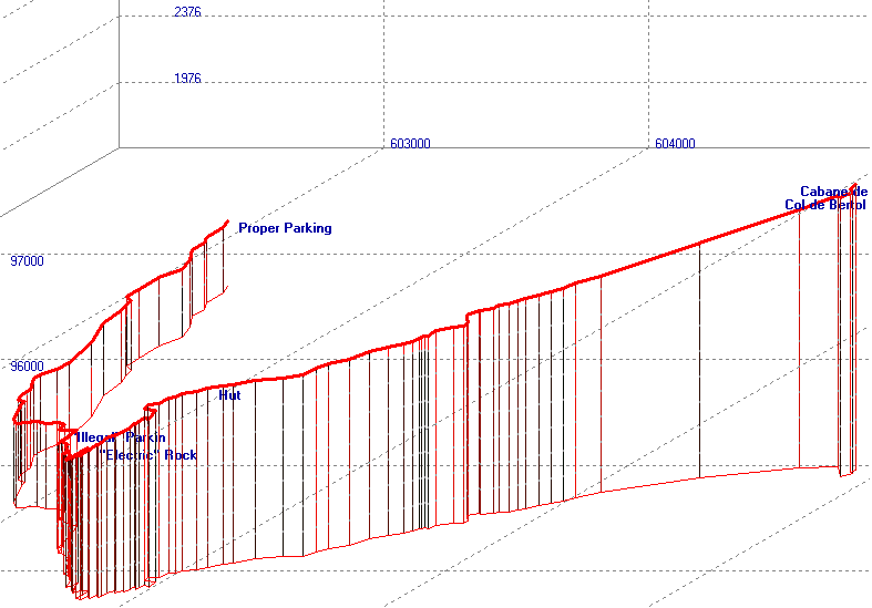 |
| 3D walking profile. Please note that the
chart is slightly disproportional: proportional chart would have been
~30% higher. |
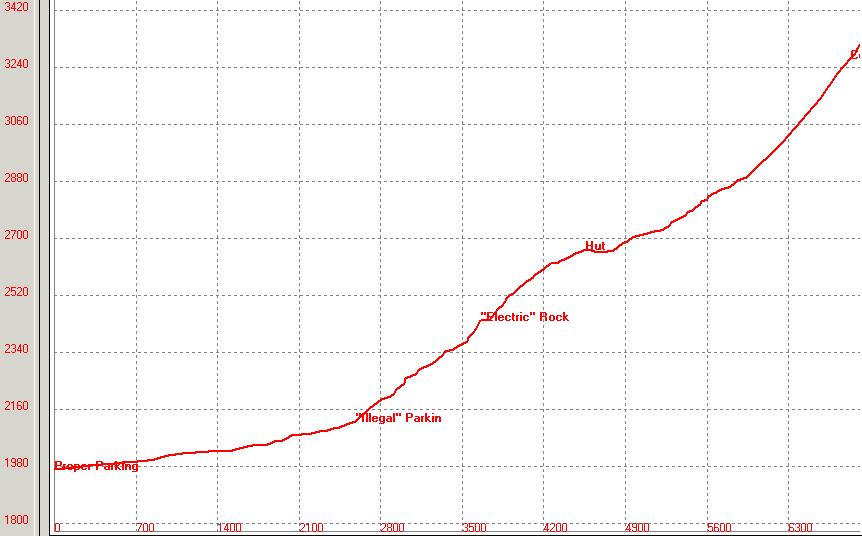 |
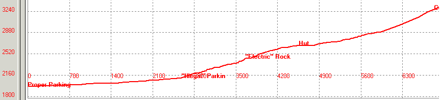
| Walking profile. Please note that
vertical scale is much larger than horizontal - it allows to see better
all route peculiarities. Of course you don't need to climb 45° slopes!
Proportional profile is two graphs below. |
|
|
 |
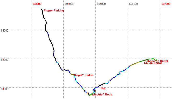
| Route land
projection. This contour repeat track of the topographical map above.
The value is in coloring scheme: the brighter color - the steeper piece
of the track is. See legend on the right. Note that these are not
degrees, but percents: 50% means 50 m up per 100 m along. |
 |
| Real, that is proportional walking
profile. Seems to be very smooth, but don't get misled. It is because
path makes zigzags (thus severely decreasing the ascend angle), rather
than goes straight against the slope. Real slopes are steeper that this
graph angles, but the path crosses them at exactly this angle! |
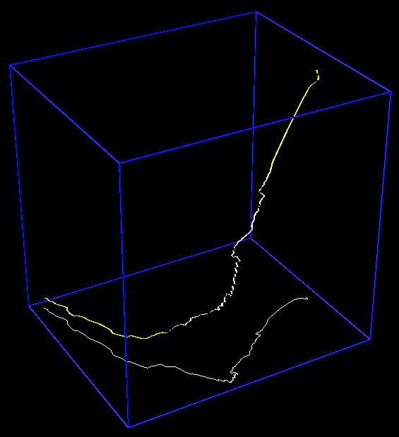 |
| 3-dimentional projection. Extremely
disproportional for the sake of showing details. The start point is at
the left bottom corner. |
|
